What Is the Manaslu Circuit Trek?
The Manaslu Circuit Trek is one of Nepal's most rewarding and least-crowded high-altitude trekking routes, circumnavigating Mount Manaslu (8,163m) — the eighth-highest mountain in the world. Located in the Gorkha District of west-central Nepal, this trek takes you through remote Himalayan villages, ancient Buddhist monasteries, dramatic gorges, rhododendron forests, and high alpine terrain, culminating at Larkya La Pass (5,160m) — one of the highest trekking passes in Nepal.
Unlike the Annapurna Circuit or Everest Base Camp, the Manaslu Circuit remains restricted, which keeps trekker numbers low and the wilderness experience raw, authentic, and deeply rewarding.
Total Distance: ~177 km
Maximum Elevation: 5,160m (Larkya La Pass)
Trek Duration: 14–18 days
Difficulty: Strenuous
Best Season: Spring (March–May) and Autumn (September–November)
Start/End Point: Soti Khola / Dharapani
Why Is the Manaslu Circuit Trek Important?
The Manaslu region sits on the Nepal-Tibet border, and trekking here is not just about altitude — it's about walking through living Tibetan Buddhist culture, bio-diverse ecosystems, and landscapes that have barely changed in centuries.
Here's why this trek matters:
Cultural immersion: The upper Manaslu valley (Nubri and Tsum) is home to Tibetan-origin communities whose language, dress, monasteries, and way of life remain untouched by mass tourism.
Ecological significance: The Manaslu Conservation Area (MCA), established in 1998, covers 1,663 sq km and protects one of the most biodiverse Himalayan ecosystems in Nepal.
Trekking heritage: It was only opened to foreign trekkers in 1992, and still requires a restricted area permit — ensuring it never becomes another crowded trail.
Mountain panorama: You trek in the shadow of Manaslu, Himalchuli (7,893m), Ngadi Chuli (7,871m), Ganesh Himal, and Baudha Himal throughout the route.
Manaslu Circuit Trek — Day-by-Day Itinerary
Day 1: Kathmandu to Soti Khola (700m) — Drive ~8–9 hrs
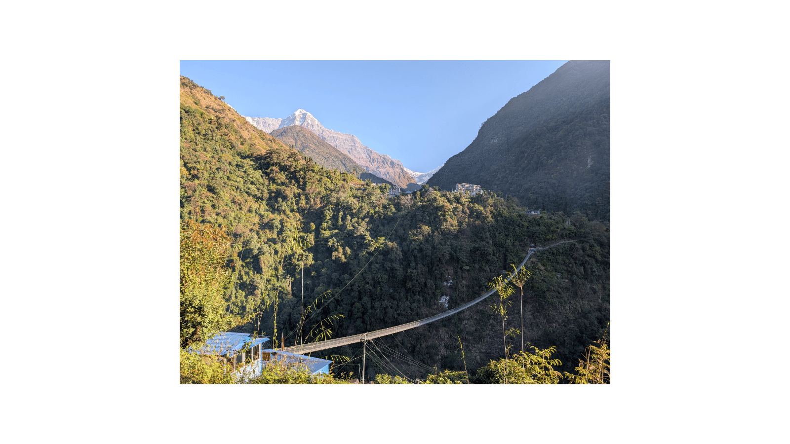
Drive from Kathmandu to Arughat Bazar via Gorkha, then continue to Soti Khola. The road follows the Budhi Gandaki River through jungle terrain. Accommodation: tea house. This day tests your patience — the road is rough, but the scenery begins to reward you immediately.
What's important today: Permit checks begin. Ensure you carry printed copies of all permits.
Day 2: Soti Khola to Machha Khola (869m) — 6–7 hrs
The trail follows the Budhi Gandaki gorge through subtropical jungle. You pass waterfalls, suspension bridges, and terraced rice fields. First wildlife sightings possible — langur monkeys, kingfishers, hornbills.
Flora: Banana groves, bamboo forest, subtropical broadleaf trees.
Day 3: Machha Khola to Jagat (1,340m) — 6–7 hrs
Trail climbs steadily through river gorges and rocky terrain. Jagat is the first police checkpoint — your permits will be checked. The village has stone-paved streets and traditional Gurung homes.
Important: This is the last point where you can turn back easily without high-altitude acclimatisation concerns.
Day 4: Jagat to Deng (1,804m) — 6–7 hrs
The gorge narrows dramatically. You cross several suspension bridges over the roaring Budhi Gandaki. At Philim, you enter the restricted zone — carry your Restricted Area Permit.
Flora: Transition from subtropical to temperate zone. Oak, alder, and rhododendron begin appearing.
Fauna: The Himalayan black bear habitat begins. Musk deer tracks are possible.
Day 5: Deng to Namrung (2,630m) — 6–7 hrs
One of the most scenic days — the trail climbs steeply through pine and fir forests. Namrung is a Tibetan-origin village with its first significant monastery. Manaslu and Siring Himal come into view.
What you achieve today: First proper Himalayan panorama. You begin feeling the altitude.
Day 6: Namrung to Samagaon (3,530m) — 6–7 hrs
Pass through Lho village with its famous monastery backed by Manaslu's north face — one of the most photographed viewpoints on this trek. Continue to Samagaon, the largest village in the upper Manaslu region.
Important rest/acclimatisation stop.
Flora: Juniper, birch, high-altitude shrubs, lichens.
Fauna: Snow leopard territory begins. Blue sheep (bharal) are regularly spotted above Samagaon.
Day 7: Samagaon — Rest / Acclimatisation Day
This day is non-negotiable. Spend it acclimatising. Options:
Hike to Manaslu Base Camp (4,800m) — 4–5 hrs return
Visit Pungen Gompa and the glacial lake
Explore Samagaon village and its 300-year-old monastery
Flora: Alpine cushion plants, edelweiss, high-altitude sedges.
Fauna: Himalayan griffon vultures, yellow-billed choughs, snow pigeons.
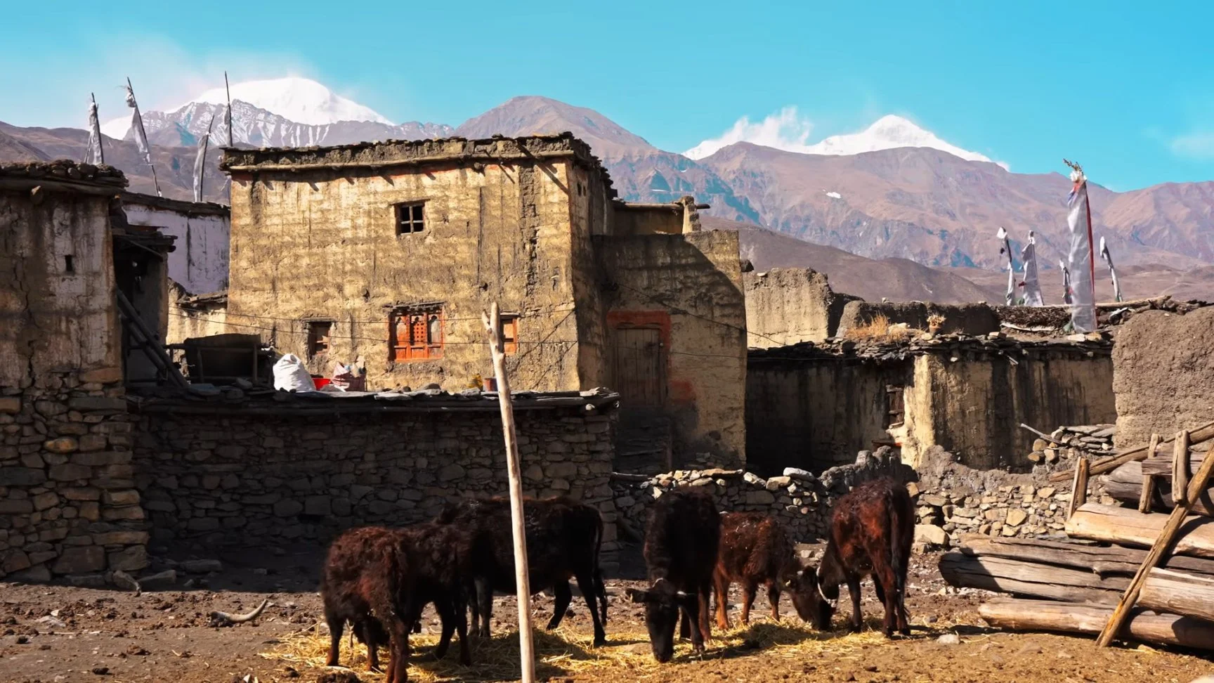
Day 8: Samagaon to Samdo (3,860m) — 3–4 hrs
Short day but important for acclimatisation. Samdo sits close to the Tibetan border. You may see Tibetan nomads and yak caravans crossing the high passes. Prayer flags and chortens mark every ridge.
What's special: On clear days, you can see into Tibet.
Day 9: Samdo — Rest / Acclimatisation + Larkya La Preparation
Second mandatory acclimatisation day before the high pass. Visit the border ridge viewpoint. Prepare gear for the 5,160m crossing tomorrow: layering system, trekking poles, gaiters, headlamp (essential for early start).
Day 10: Samdo to Dharamsala/High Camp (4,460m) — 3–4 hrs
Short hike to high camp. This is a basic shelter — sleeping conditions are primitive, but the views are spectacular. Early to bed — wake time is 3–4 AM.
Day 11: Dharamsala → Larkya La Pass (5,160m) → Bimthang (3,590m) — 9–10 hrs ⭐ HARDEST DAY
The climax of the entire trek. Start in darkness. The ascent to Larkya La involves a steep glacial approach with potential ice and snow. At the top: 360-degree panorama of Manaslu, Cheo Himal, Kang Guru, and Annapurna II.
The descent to Bimthang is long, steep, and knee-punishing. But arriving in a green valley after the icy pass is one of the most emotionally powerful moments in Himalayan trekking.
Factual elevation gain/loss: +700m / −1,570m in one day.
Gear critical: Crampons (in early spring and late autumn), trekking poles, warm layers — temperature at the pass can drop to −15°C even in October.
Day 12: Bimthang to Tilije (2,300m) — 5–6 hrs
Dramatic descent through rhododendron and fir forests. Bimthang Meadows is one of the most beautiful campsites in Nepal. You re-enter the temperate zone — oxygen feels abundant.
Flora: Dense rhododendron (Nepal's national flower) in full bloom during spring. Magnolia, oak forest.
Fauna: Red panda habitat. Himalayan tahr. Blood pheasant.
Day 13: Tilije to Dharapani (1,860m) — 4–5 hrs
You rejoin the Annapurna Circuit trail at Dharapani. The cultural shift is visible — more tourist infrastructure, more trekkers. The Manaslu solitude is behind you.
Optional: Extend to Chame or Besisahar for the Annapurna Circuit combination.
Day 14: Dharapani to Kathmandu — Drive ~8–9 hrs or fly Besisahar–Kathmandu
Return to Kathmandu via jeep/bus through Besisahar. Many trekkers choose to overnight in Besisahar and return the next morning.
Permits Required for Manaslu Circuit Trek
The Manaslu Circuit is a restricted area trek — the most regulated category in Nepal. You cannot trek independently; you must be in a group of at least two trekkers with a licensed guide.
Permit | Issuing Authority | Cost (2026) |
|---|---|---|
Restricted Area Permit (RAP) | Department of Immigration | USD 100/week (Sep–Nov, Mar–May); USD 75/week (Dec–Feb, Jun–Aug) |
Manaslu Conservation Area Permit (MCAP) | National Trust for Nature Conservation | NPR 3,000 (~USD 22) |
Annapurna Conservation Area Permit (ACAP) | NTNC | NPR 3,000 (~USD 22) — required if exiting via Dharapani |
TIMS Card | Nepal Tourism Board | USD 20 (guided) |
Important: The RAP is calculated per week, not per trek day. A 14-day trek requires 2 weeks = USD 200 per person in peak season. Permits must be obtained in Kathmandu before departure — they cannot be issued on the trail.
Essential Equipment List
Clothing
Thermal base layers (top and bottom) × 2
Fleece mid-layer jacket
Down jacket (600-fill minimum)
Waterproof hardshell jacket and pants
Trekking pants × 2
Wool/synthetic trekking socks × 5 pairs
Gaiters (essential for Larkya La crossing)
Sun hat + warm wool hat
Gloves: liner gloves + insulated outer gloves
Balaclava
Footwear
Waterproof, ankle-support trekking boots (broken in before trek)
Camp sandals/shoes
Crampons or micro-spikes (for early spring/late autumn Larkya La crossing)
Gear
55–65L trekking backpack
Trekking poles (critical for Larkya La descent)
Sleeping bag rated to −15°C
Headlamp + spare batteries (lithium preferred in cold)
Sunglasses (UV400 minimum — glacial glare is intense)
Water purification tablets or a filter
2× 1L water bottles or hydration bladder
Altitude sickness medication: Diamox (Acetazolamide) — consult your doctor
Health & Safety
Personal first-aid kit
Blister treatment (Compeed/moleskin)
Lip balm + high-SPF sunscreen
Hand sanitizer
Altitude sickness: Know the symptoms — headache, nausea, dizziness, loss of appetite. Descend immediately if symptoms worsen.
Flora of the Manaslu Region
The Manaslu Conservation Area contains over 2,000 plant species across five ecological zones:
Subtropical zone (below 1,000m): Banana, bamboo, subtropical broadleaf forests
Temperate zone (1,000–2,400m): Oak, alder, maple, rhododendron begin
Sub-alpine zone (2,400–3,600m): Rhododendron forests (arboreum, campanulatum), fir, birch, juniper
Alpine zone (3,600–4,400m): Dwarf rhododendron, edelweiss (Leontopodium nivale), Himalayan gentian, primula, artemisia
Nival zone (above 4,400m): Cushion plants, lichens, mosses only
Spring highlight: The rhododendron blooms from March to May, turns the hillsides between Bimthang and Tilije into a wall of crimson, pink, and white — arguably the most spectacular rhododendron display in all of Nepal.
Fauna of the Manaslu Region
The Manaslu Conservation Area is one of Nepal's most important wildlife corridors, harbouring species rarely seen elsewhere:
Species | Altitude Zone | Sighting Likelihood |
|---|---|---|
Snow leopard (Panthera uncia) | 3,000–5,000m | Rare — tracks common above Samagaon |
Red panda (Ailurus fulgens) | 2,200–4,000m | Moderate — Bimthang–Tilije stretch |
Blue sheep / Bharal | 3,500–5,500m | Very common above Samagaon |
Himalayan tahr | 2,500–4,500m | Common on rocky ridges |
Musk deer | 2,500–4,000m | Occasionally sighted |
Himalayan black bear | 1,500–3,500m | Rare sightings; tracks common |
Langur monkey | Below 2,000m | Common in the lower gorge |
Birds: Over 110 bird species recorded, including Himalayan monal (Nepal's national bird), blood pheasant, Himalayan griffon vulture, lammergeier (bearded vulture), snow partridge, yellow-billed chough, and Tibetan snowfinch.
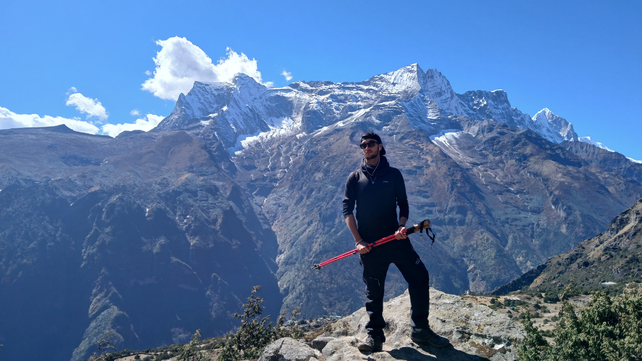
Who Should Come on the Manaslu Circuit Trek?
Ideal candidates:
✅ Trekkers with prior high-altitude experience (Everest Base Camp, Annapurna Circuit, or similar)
✅ People seeking solitude and authentic cultural immersion away from tourist crowds
✅ Wildlife and nature enthusiasts
✅ Those with 14–18 days available
✅ Trekkers aged 18–65 in good cardiovascular health
✅ Anyone drawn to Tibetan Buddhist culture, monasteries, and remote village life
✅ Photographers — the Lho-Samagaon stretch is extraordinary
Who Should NOT Attempt This Trek?
❌ First-time trekkers with no high-altitude experience
❌ Anyone with serious cardiac, respiratory, or blood pressure conditions (consult a doctor first)
❌ Trekkers unwilling to hire a licensed guide (legally required)
❌ Solo trekkers (minimum group of two required by Nepal law)
❌ Those with fewer than 14 days available — rushing this route is dangerous
❌ Trekkers who are pregnant (altitude above 3,500m not advisable)
❌ Anyone uncomfortable with very basic accommodation (some tea houses lack electricity and hot showers)
What You Achieve on the Manaslu Circuit Trek
Crossing Larkya La Pass (5,160m) — a genuine high-altitude achievement that matches EBC in difficulty
Circumnavigating an 8,000m peak — walking the entire base of the world's 8th highest mountain
Cultural depth — spending nights in Samagaon and Samdo, interacting with Nubri communities
Wildlife encounters — blue sheep herds, red panda, raptors, daily
Self-discovery — long days, limited connectivity, raw terrain forces genuine introspection
Combination options — connect seamlessly to the Annapurna Circuit at Dharapani
What You Won't Like About This Trek
Being honest matters — not every day is Instagram-perfect:
⚠️ The drive to Soti Khola is 8–9 hours on rough, dusty mountain roads — exhausting before the trek even starts
⚠️ Tea house quality drops significantly above Samagaon — expect shared pit toilets, no hot showers, basic blankets
⚠️ Larkya La Day is brutal — 9–10 hours, pre-dawn start, possible ice and snow, extreme cold at the pass, punishing descent
⚠️ Limited connectivity — mobile signal disappears after Jagat; power banks are essential
⚠️ Altitude sickness is a real risk — two acclimatisation days are mandatory, not optional
⚠️ High permit costs — at USD 200+ per person in peak season, it's one of Nepal's most expensive trek permits
⚠️ You must have a guide — no independent trekking allowed; budget accordingly (guide fees: USD 25–35/day)
Detail Info
Best months | Oct–Nov, Mar–May |
Avoid | June–August (monsoon — trail floods, leeches), January–February (extreme cold, Larkya La often closed) |
Average daily trekking hours | 5–8 hours |
Accommodation | Tea houses throughout; basic above 3,500m |
Food on the trail | Dal bhat, noodle soup, pasta, eggs, porridge — limited variety above Samagaon |
Currency | Nepali Rupee — carry sufficient cash; no ATMs after Arughat |
Altitude sickness protocol | "Walk high, sleep low." Descend immediately if symptoms worsen |
Guide requirement | Mandatory — minimum 2 trekkers + licensed guide |
Porter | Recommended — max 20–25kg per porter; tips expected |
You Can Also Visit this Trip as Well
Our guides are certified, locally trained, and carry first-aid and altitude sickness response training. We do not cut corners on safety.